|
previous topic :: next topic |
| Author |
Message |
gtm
Since 04 Jul 2005
36 Posts
|
 Thu Aug 02, 07 11:08 am Sauvie Island Sensor Location? Thu Aug 02, 07 11:08 am Sauvie Island Sensor Location? |
 |
|
This was sent to me as a potential sensor location with the farm house serving as a location for collecting data from a remote sensor.
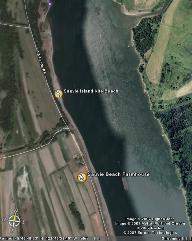
Any comments on how well this would work? Are there any structures at the kite beach where a remote sensor could be mounted?
Thanks
George McLean
|
|
|
Bettyboarder

Since 18 Mar 2005
1823 Posts
PDX/ White Salmon
XTreme Poster
|
| Thu Aug 02, 07 11:19 am |
|
|
There is a channel marker (?) at the norther tip of the beach that would be perfect. It's sits high enough that no one could mess with it. Anyone have any pictures of what I am talking about.
_________________
Join the CGKA! Membership is only $10! Sign up at http://cgka.net/become-a-member/ |
|
|
Mark

Since 20 Jun 2005
3679 Posts
I need my fix because I'm a
Naishaholic
|
| Thu Aug 02, 07 11:46 am |
|
|
Do u mean the one with the red top? Great location. It does NOT have power though.
George
the power lines run all the way down the reeder road. The sensor would need to be high up as there is a earth dike that rises about 15'. It would be nice to get one as close to your marked beach spot as possible. THe wind seems to be flukey if you go to far north or south. Especially south.
Mark
_________________
Cleverly disguised as an adult...
www.naishkites.com |
|
|
pdxmonkeyboy

Since 16 May 2006
6081 Posts
forever labled as the
retired kiter & motorhead Unicorn Master
|
| Thu Aug 02, 07 2:45 pm |
|
|
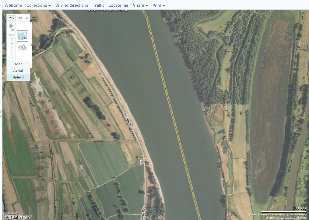
here is a higher resolution picture. If you use http://maps.live.com/
you can zoom in and see the dolphins in the water that they are talking about. They are the property of the Corps of engineers as far as I know (at least in the other areas of the Columbia). They are not maintained or replaced if they are damaged as they are not channel markers.
 |
| |
new-2.jpg |
|
|
|
|