|
previous topic :: next topic |
| Author |
Message |
Nak

Since 19 May 2005
4337 Posts
Camas
Site Lackey
CGKA Member
|
 Sun Oct 28, 07 8:42 pm Sun Oct 28, 07 8:42 pm |
 |
|
| pkh wrote: | | The pic above is from Henry and I's expedition to Corbett. Definitely has some potential as a backup spot for when Rooster is nuked out. |
Corbett? Where did you guys launch?
|
|
|
pkh

Since 27 Feb 2005
6549 Posts
Couve / Hood
Honored Founder
|
| Sun Oct 28, 07 9:30 pm |
|
|
| Nak wrote: | | pkh wrote: | | The pic above is from Henry and I's expedition to Corbett. Definitely has some potential as a backup spot for when Rooster is nuked out. |
Corbett? Where did you guys launch? |
Park at Corbett exit (you'll see where) then walk along highway to any good spot to climb down. Plenty of beach, lots of sand in-between the wing damns.
Cottonwood is probably easier overall, but Corbett is much closer to RR if you get blown out there.
|
|
|
Rico

Since 13 Mar 2005
1219 Posts
Vancouver
Photographer
|
| Sun Oct 28, 07 9:51 pm Corbett |
|
|
Felt like Lewis and Clark except instead of canoeing down the Columbia we were trekking down I-84.
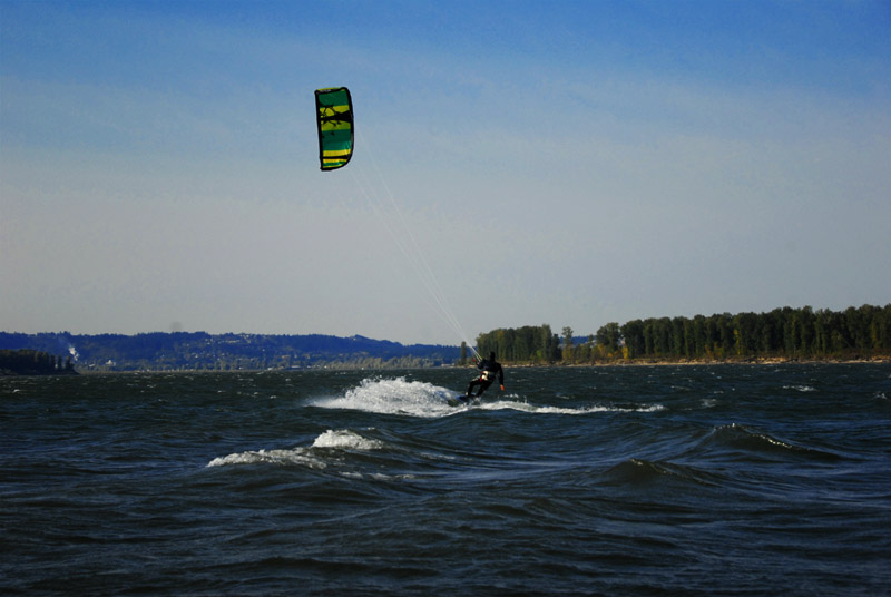 |
| Corbett |
DSC_0397 corbet.jpg |
|
|
|
Nak
Since 19 May 2005
4337 Posts
Camas
Site Lackey
CGKA Member
|
| Mon Oct 29, 07 9:56 am |
|
|
| pauls wrote: | | Nak wrote: | | I think the access to that beach would be by parking at Cottonwood and riding mountain bikes up the dike road to that beach. I haven't ridden it yet, so I don't know if you run into a "Private Property" sign before you get there. |
Yep, you hit signs before you get far enough up the trail to access the beach, I checked it out a couple of winters back  |
Thanks for the heads up... That sucks though. I was thinking that would be a really nice spot.
|
|
|
trevorsmith

Since 25 Apr 2005
501 Posts
PDX
Addicted
|
| Mon Oct 29, 07 11:58 am |
|
|
| pauls wrote: | | Nak wrote: | | I think the access to that beach would be by parking at Cottonwood and riding mountain bikes up the dike road to that beach. I haven't ridden it yet, so I don't know if you run into a "Private Property" sign before you get there. |
Yep, you hit signs before you get far enough up the trail to access the beach, I checked it out a couple of winters back |
I'm pretty sure the owners of the property, don't own the sea wall which is where the trail is. And you always have rights to the high water mark.
|
|
|
pauls
Since 20 Jun 2005
564 Posts
Northern Portugal
Addicted
|
| Mon Oct 29, 07 1:54 pm |
|
|
| The walking and biking trail runs along the top of the dyke, after about a mile it was blocked by a wire fence and no trespassing signs. It was two winters ago i walked up there so things may have changed. Either way if anyone goes up and takes a look please post what you find. Water was high back then, right now you might be able to climb down to the sand and hike further east.
|
|
|
BigR

Since 05 Jul 2005
372 Posts
White Salmon
Obsessed
|
| Mon Oct 29, 07 3:15 pm |
|
|
| and after that then you wouldn't be trespassing as long as you stay on the low water line?
|
|
|
Nak
Since 19 May 2005
4337 Posts
Camas
Site Lackey
CGKA Member
|
| Mon Oct 29, 07 3:31 pm |
|
|
| I don't think you can get to the beach by hiking below the high water line. However, just because it's fenced and marked "No Trespassing" doesn't necessarily mean you can't use the road. I've seen many a public road marked that way, wrongly, by the folks that have the lease on the grazing rights. I think the next step is to find out what public agency owns the land. I think it's a National Wildlife Refuge. Once we know who owns it for sure, we can investigate access. It's possible that it is private property, but it seems like that dike would have to be public property. Maybe not, but worth looking into.
|
|
|
|